Lorence Creek is a “dry creek” and part of the Salado Creek watershed basin. Lorence Creek has been designated in the Salado Creek Watershed Master Plan Report as a major flood damage center. The Federal Emergency Management Administration floodplain maps show all the Lorence Creek bed as a flood hazard area and severe flooding has occurred several times in past years. One of the most notable floods occurred in July 2002. Pictures extracted from video of that flood show a 280-foot wide raging torrent resulting in significant flood water flowing into backyards along the creek. A portion of Lorence Creek was purchased by the City of San Antonio in 2003 and established as the city park Lorence Creek Park, retaining its natural setting in part because of the flooding issues discussed herein
Background
Living in San Antonio brings certain expectations about the weather. From experience, it can be dry for long periods of time or the weather can become severe to include damaging hail and torrential rains. These rains often cause flash flooding in low-lying areas and roadways causing property damage and even death. The dry creek beds that our roads often cross in San Antonio are a major feature of our watershed areas.
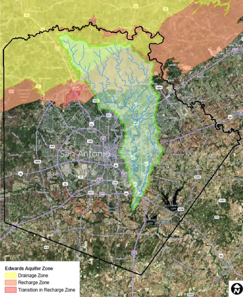
One major watershed in Bexar County is the Salado Creek Basin. It extends southward from North Central Bexar County roughly paralleling U.S. Highway 281 on the eastern side of the city. The Salado Creek watershed continues to the south until it empties into the San Antonio River at a point about 2 ½ miles south of Loop 410. (1)
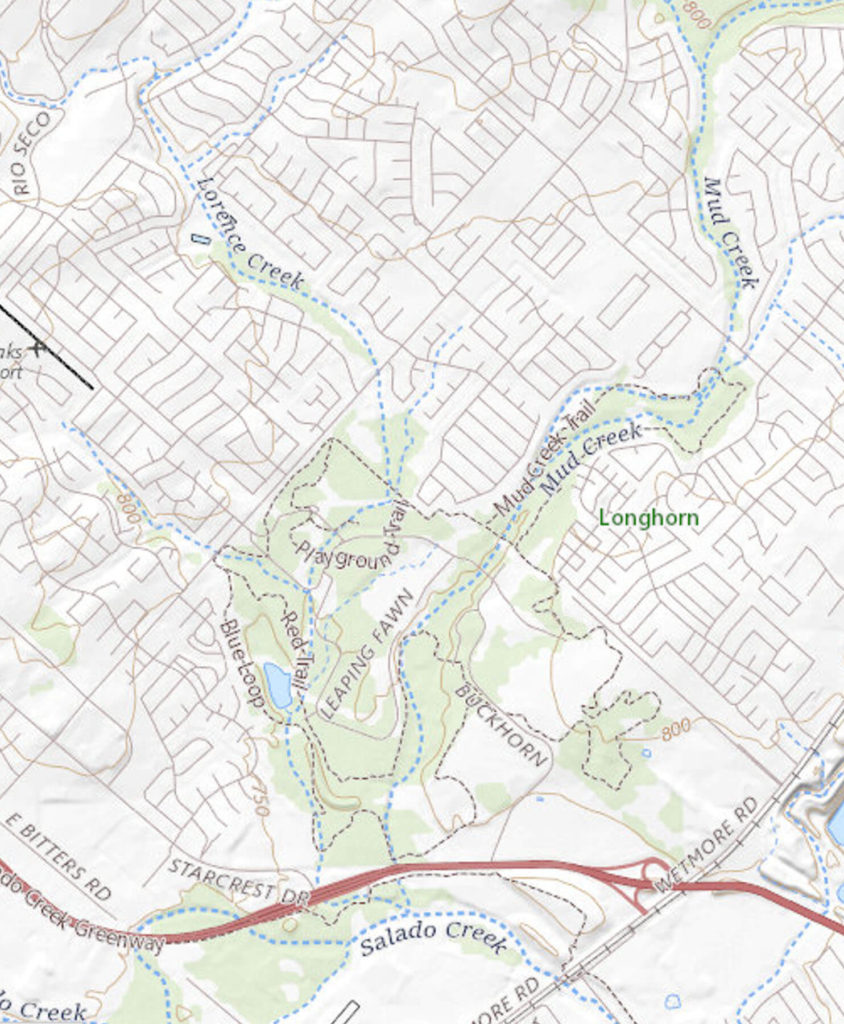
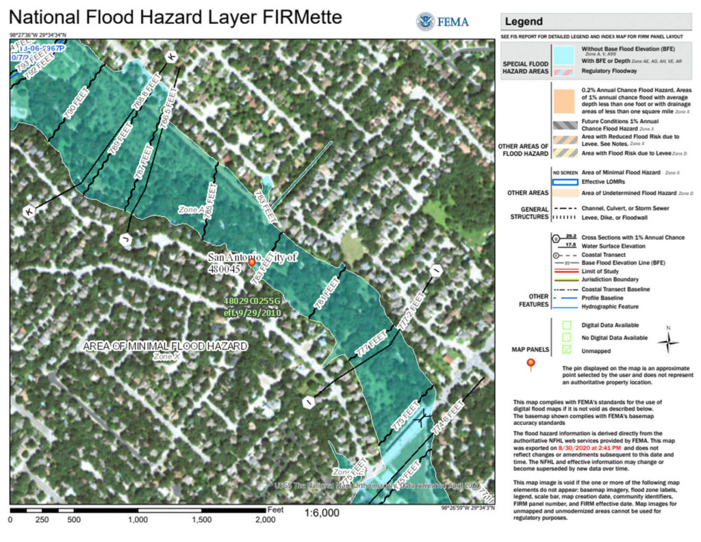
U.S. Geological Survey maps of the Salado Creek watershed designate most of the creeks north of Wurzbach Parkway as intermittent or dry. Mudd Creek and Lorence Creek are two major tributary channels and join Salado Creek just north of San Antonio International Airport as noted in Figure 2.
Lorence Creek
A Salado Creek Watershed Master Plan Report was prepared for the San Antonio River Authority in 2011. The plan was prepared under a contract to Atkins, North America Inc. The lead-in to the report’s Executive Summary describes the project.
“The 218-square mile Salado Creek Watershed, located in north central Bexar County, Texas, has experienced recurring flood problems dating back into the 1800s and 1900s and more recently in the 1998 and 2002 flood events. In addition to being a major contributor to these persistent flooding problems, past and ongoing urbanization has also resulted in the occurrence of water quality degradation in the watershed with the potential for conditions to become progressively worse. To address these and other issues, the San Antonio River Authority (SARA) authorized Atkins North America, Inc. (Atkins) to develop a multi-phased Salado Creek Watershed Master Plan (SCWMP) that addresses flooding and water quality issues while integrating elements of environmental protection, stream stability, and recreational planning.” (1)
A major objective was to: “Identify the major flood damage reaches (damage centers) within the Salado Creek main channel and major tributary channel areas.” (1)
In this report, Lorence Creek is named as Damage Center 3 (DC03). It was selected by the BREWM team “due to the number of structures that flood from relatively frequent events between U.S. 281 and Jones Maltsberger crossing. The affected properties are mainly residential.” (1)
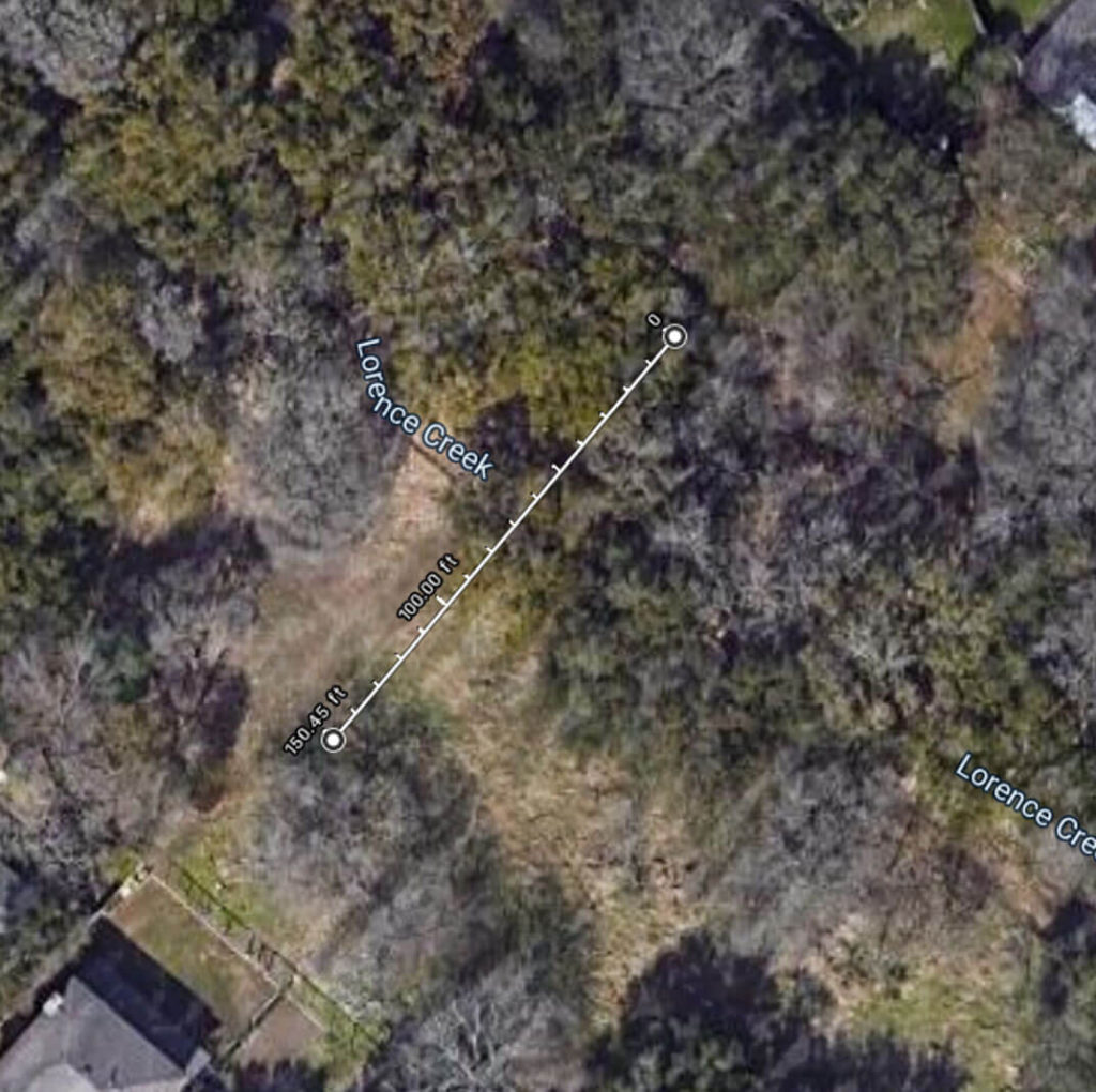
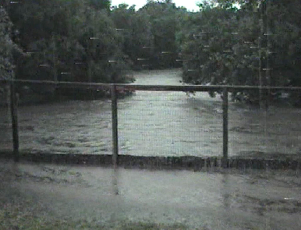
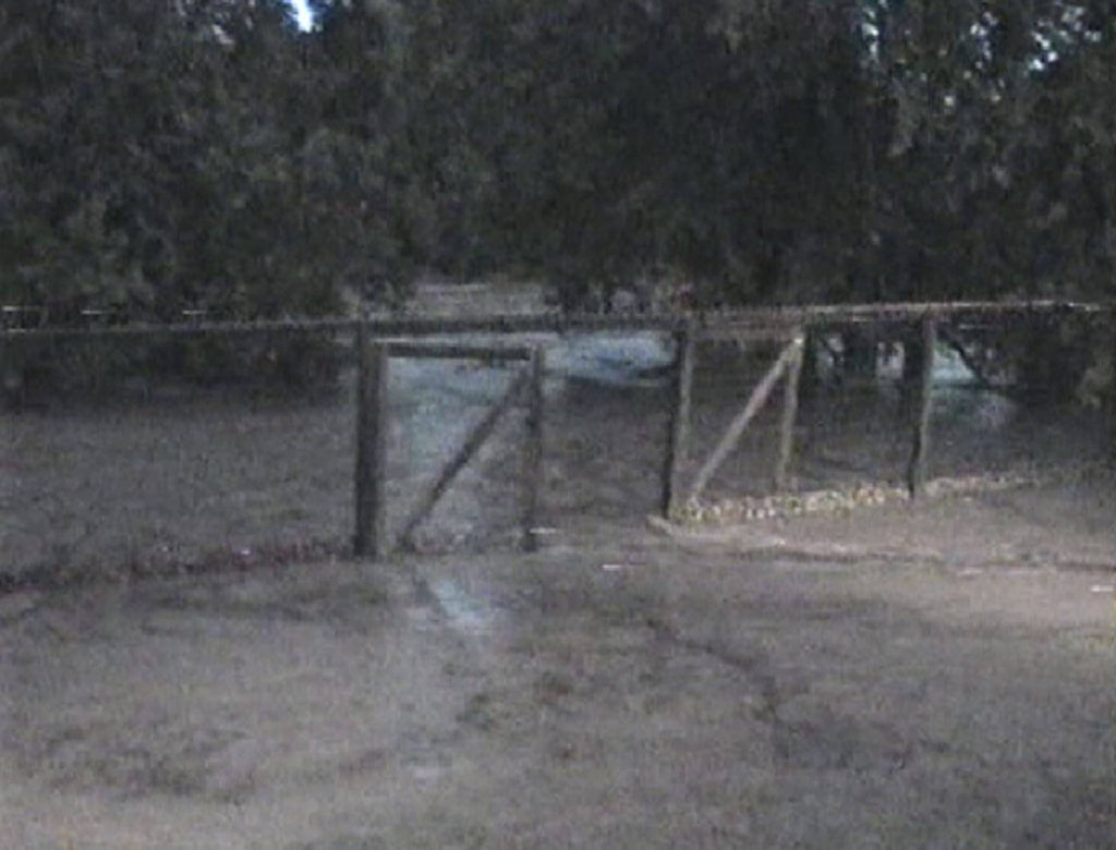
As indicated earlier, storms in San Antonio can produce heavy localized downpours. When these storms occur over the upper Salado Creek basin (which includes Lorence Creek) quickly rising, rapidly flowing, and deep flooding occurs in Lorence Creek. Almost any moderate rain will cause Lorence Creek to flow, while heavy rain may produce a stream of significant flow and depth in the creek area behind Oak Castle and Brookline and Moss Bluff on the other side. Usually, several storms will occur every year resulting in a fast-moving 150-foot-wide stream having a depth of 4 feet. (Figure 3)
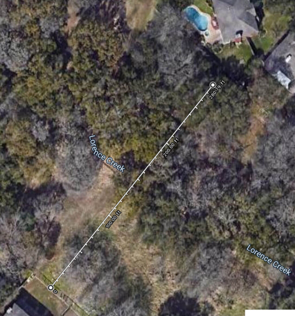
Occasionally a particularly heavy rainstorm will produce a raging torrent spanning the entire flood plain having a width of 280 feet and a depth of ten or more feet. Pictures depicting these widths in relation to Lorence Creek are provided (Fig. 4) as well as the FEMA flood hazard area encompassing the lower reach of Lorence Creek. (Figure 5)
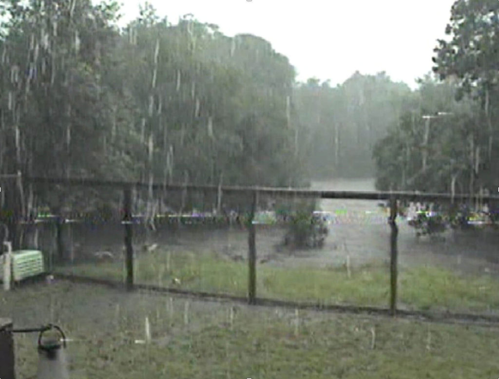
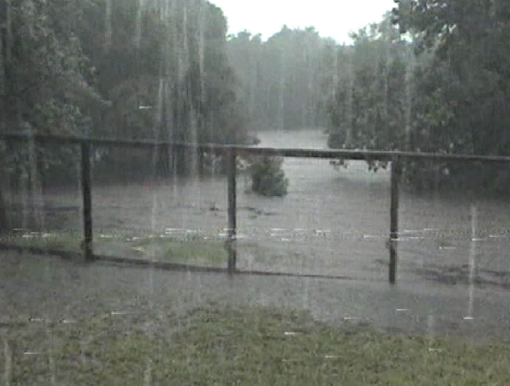
Severe flooding occurred in 1998 when the creek bed filled completely, and water overflowed into back yards. Again in 2002, a severe storm caused this to occur. A video of the event in 2002 shows a raging river 11 feet deep and higher than the 100-year flood plain. The water was deep enough to pile debris on backyard fences to a depth of over 1 foot. The video also shows large limbs and other significant debris moving rapidly downstream. Another video taken in 2013 shows a similar filling of the creek bed “brim to brim.” See Figures 6, 7, 8, 9).
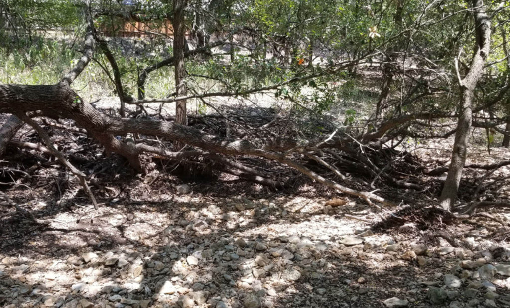
After these flooding events, the force and height of the water can be clearly seen by the amount and location of debris along the creek bed. (Figures 11, 12).
Lorence Creek Park
In April 2003, the City of San Antonio purchased the 12-acre tract following the center line of Lorence Creek heading southeast from Henderson Pass as part of the Lorence Creek/Upper Salado Creek Greenway Improvements Project. (3)
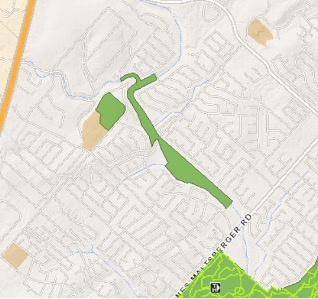
The northwest park boundary begins where Lorence Creek crosses Heimer Road and abuts Shadow Cliff Street. The Park then extends southeast to Henderson Pass and continues to privately-owned land on the west side of Jones-Maltsberger Road. The northeast and southwest sides of the park border on residential houses. (See Figure 13.)
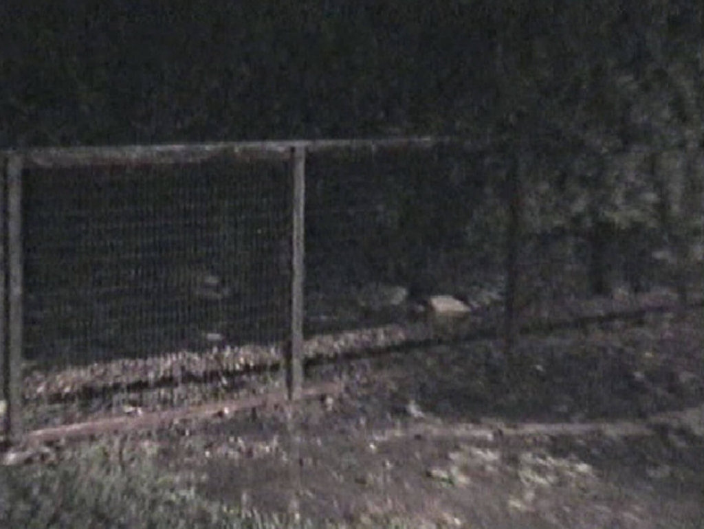
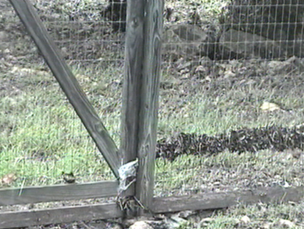
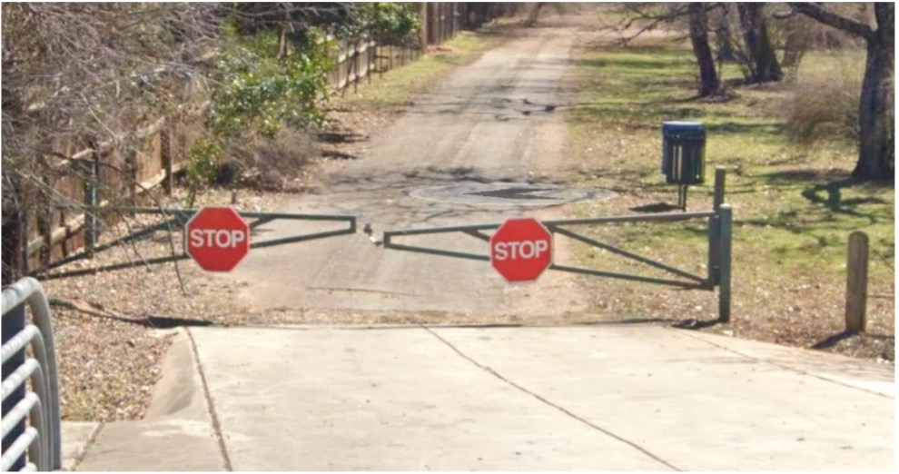
The Park is not contiguous with McAllister Park and is not open to routine vehicular traffic. There is a maintenance gate (figure 14) entering the park from Henderson Pass used by City Park maintenance vehicles for removal of debris and trash washed into the park after flooding, as shown in earlier figures in this article
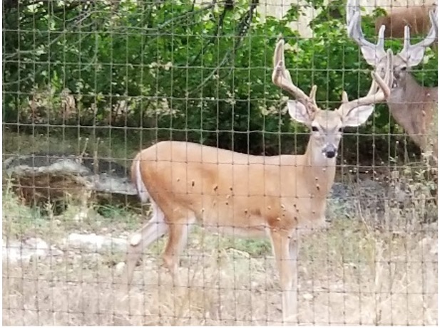
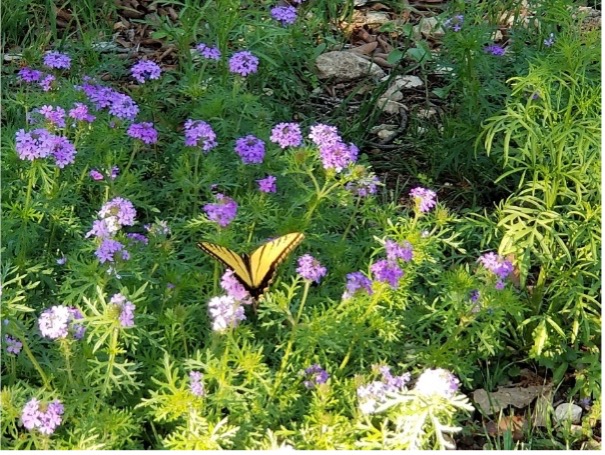
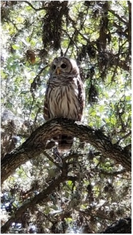
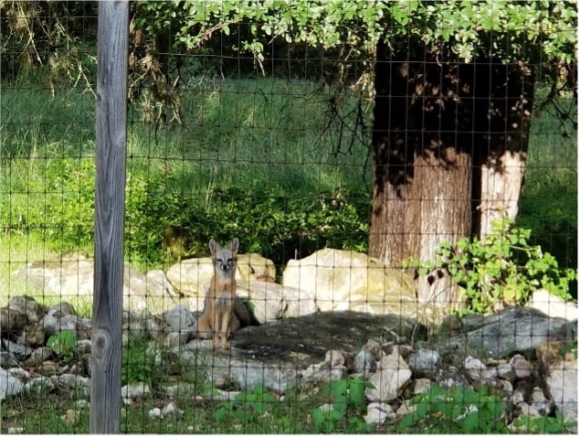
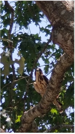
Although Lorence Creek Park does not have formally defined trails, it is open and accessible to the public for non-motorized traffic via several entrances. The frequent flash flooding during heavy rains would make permanent trails difficult and costly to maintain. However, the rough terrain is suitable for hiking, horseback riding and observation of numerous types of wildlife. Deer, coyotes, foxes, skunks, raccoons, opossums, squirrels, hawks, owls, lizards and a variety of songbirds can be seen (see pictures above) in the park. Lorence Creek Park is a microcosm of the Texas Hill Country flora and fauna which attracts a variety of native animals and insects.
References
1. Adkins North America, Inc., (2011). San Antonio River Authority Salado Creek Master Plan Report, Phase I. Retrieved from
https://www.sariverauthority.org/sites/default/files/2019-11/Salado_Creek.pdf
2. U.S. Geological Survey, Topographical Maps, (2006). Retrieved from
https://viewer.nationalmap.gov/basic/?basemap=b1&category=histtopo,ustopo&title=Map%20View#startUp
3. City of San Antonio, (2003). Ordinance 97474.
4. City of San Antonio Parks and Recreation, (2021), Parks and Recreation Web Site. Retrieved from
https://www.sanantonio.gov/ParksAndRec/Parks-Facilities/Trails/Greenway-Trails
Great job, Jay Miner.